The One and a clamp
Your contractor mounts the One beside the existing controller and clamps the valve common. In Watch, no valve wires move.
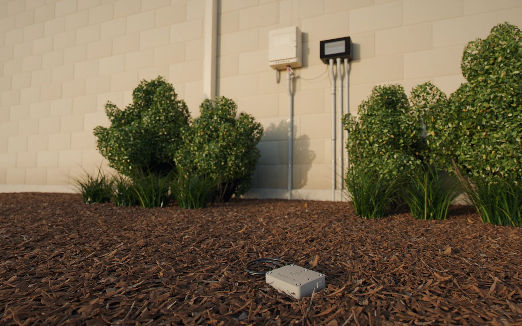
A Droughtless One beside your controller and soil probes in the ground. It checks every run against the soil, then takes over the watering when you’re ready.
The One mounts beside your controller and reads every run it
makes.
Soil probes measure the soil at the roots.
Your contractor mounts the One beside the existing controller and clamps the valve common. In Watch, no valve wires move.
A wireless node with up to two soil probes, set at root depth where the zone actually waters. It reports back to the One by radio, so no wire runs to the cabinet.
Where the probes go
One shallow probe in the spray pattern.
Two probes inside the dripline, one shallow and one deep.
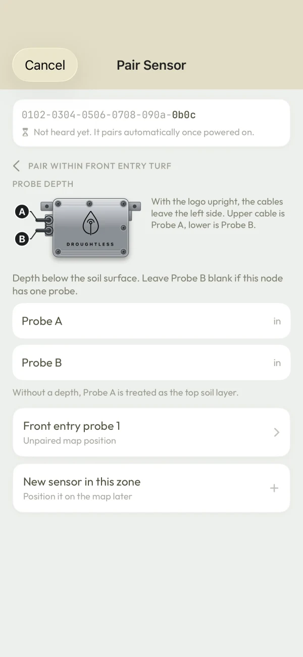
Standard depths from the Sense install guide. The installer records each probe’s depth when pairing the node in the app.
The One runs on 24 VAC. Sense runs on two lithium AA cells.
Nothing joins your property’s network, so there’s no IT ticket. The sensor radio is encrypted.
A flow meter adds leak and broken-line checks. Freeze sensors and pumps connect to the One too.
The clamp reads the valve wiring, so the brand on the cabinet doesn’t matter.
Keep IQ4, ICC Pro or Sentinel. Central control logs that a valve was told to run. Droughtless checks that the water reached the roots.
The clamp goes on the field wiring, so there’s nothing to integrate.
Any brand. The clamp sees every run, and each station is mapped to its zone at commissioning.
Two-wire decoder controllers such as ESP-LXD and ICC2 connect for Watch.
Connects through the Hydrawise cloud, which lets Droughtless run, stop and suspend zones.
Sense checks that each zone’s soil gets wetter after the timer runs.
Sense and the clamp cover the soil and the controller. Add a flow meter and it watches the pipes too.
| Fault | Needs | Watch | Control |
|---|---|---|---|
| Zone didn’t run when scheduled | The clamp, or the One in Control | Included | Included |
| Zone ran, soil didn’t get wetter | Sense | Included | Included |
| Soil too dry for the plants | Sense | Included | Included |
| Water flowing with no zone running, or a valve stuck open | Flow meter | Included | Included |
| Broken head, cut lateral, clogged drip line | Flow meter | Included | Included |
| Shorted or broken valve wire | The One’s current sensing | No | Included |
| Pump running dry | Pump on the One and a flow meter | No | Included |
| Freeze | Freeze sensor, thermometer or the forecast | Alerts | Shuts off |
| Probe offline, low battery, sensor fault | Sense | Included | Included |
Every alert links to its evidence. The crew opens it from the text or email with no account, sees what was measured, and marks it real or false.
When a fault holds a zone’s watering, your crew hears first. Everyone else on the alert list hears only if it is still open 24 hours later.
Stuck valves, pump faults and mainline leaks text the whole alert list at once, quiet hours or not.
The alert closes when the next run gets the soil wetter. The crew’s verdict goes into the Season Scorecard.
Each contact picks English or Spanish and sets their own quiet hours.
 Droughtless Evidence
Practice Green · Sunridge Corporate Campus
An ET controller estimates what the landscape lost. Droughtless also measures what the root zone still holds, so it skips the runs the plants don’t need.
Root-zone outlook
Use the left and right arrow keys to step through the days. The same values are in the table that follows.
The root zone stays above the watering threshold until the rain arrives, so nothing runs this week. If the rain misses, the next night’s plan adds a run.
Example zone: Bermuda turf on clay loam, from the demo site.Every watering runs as short pulses with soak time between them. Valves run together only when a pipe-network pressure check passes; otherwise they take turns.
In Control, watering days, hours and drought-stage rules are checked before any valve opens, manual and offline runs included. An override needs a written reason.
The plan lives on the One and covers the week ahead. If the cell link drops, it keeps running that plan for up to 7 days.
Through the pilot season it checks your controller and changes nothing. Then you decide whether the One takes over, one controller at a time.
Every run is checked against the soil. Each night you also see the plan it would have run instead, zone by zone.
Once the valves are mapped, plants and preferences are set and the One is online, you turn on Control. Your contractor moves the valve wires to the One.
The Monthly Digest is the month’s operating record. The Season Scorecard lists every fault caught and how it ended. Both arrive by email on the schedule you set, with each alert linked to its evidence.
Droughtless Contents
What ran, what was missed and the water each zone got.
What was flagged, what was fixed and what is still open.
Which zones run short in the days ahead.
Droughtless Contents
Every alert, with the crew’s verdict.
Each fault, how long it took to alert, and the fix.
The water each zone got across the season.
MWELO Annual · WUE Data · LEED WE · GRESB Export · Audubon ACSP · Board Presentation · Insurance · Regulatory Submission
Your current schedule and the Droughtless schedule run through the same soil model on the same weather, rain included. The baseline keeps whatever your controller already does, such as a rain sensor’s skips.
In a season simulated on 2023 weather, the Droughtless schedule applied 22% less water than a fixed summer timer, and 14% less than the same timer with a rain sensor.
Your contractor installs both. The install guides are linked below.
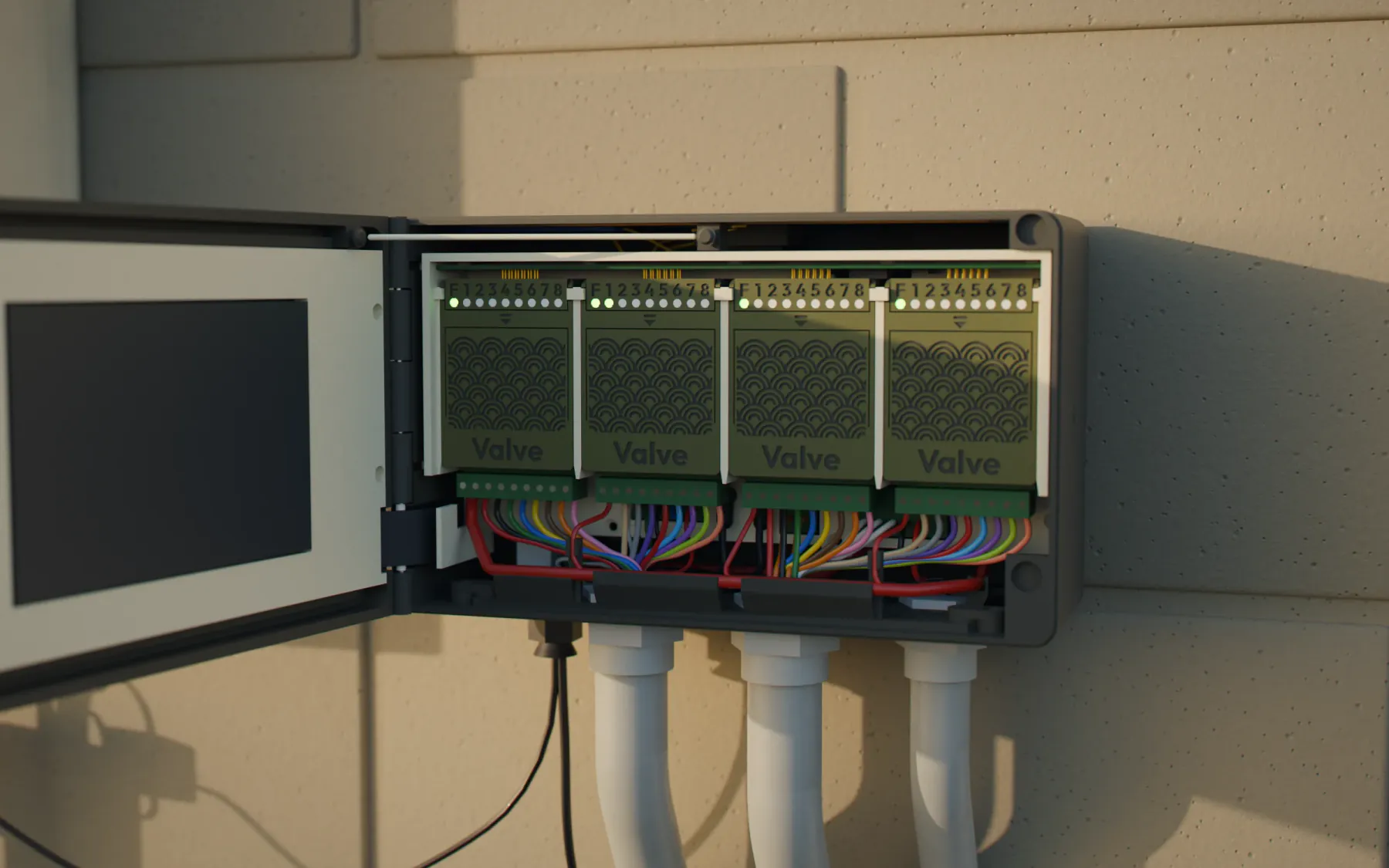
32 zones on four swappable valve cartridges, LTE built in, and outputs for a pump or master valve. It senses solenoid current on every run, so a shorted or broken valve wire shows up on the zone that ran.
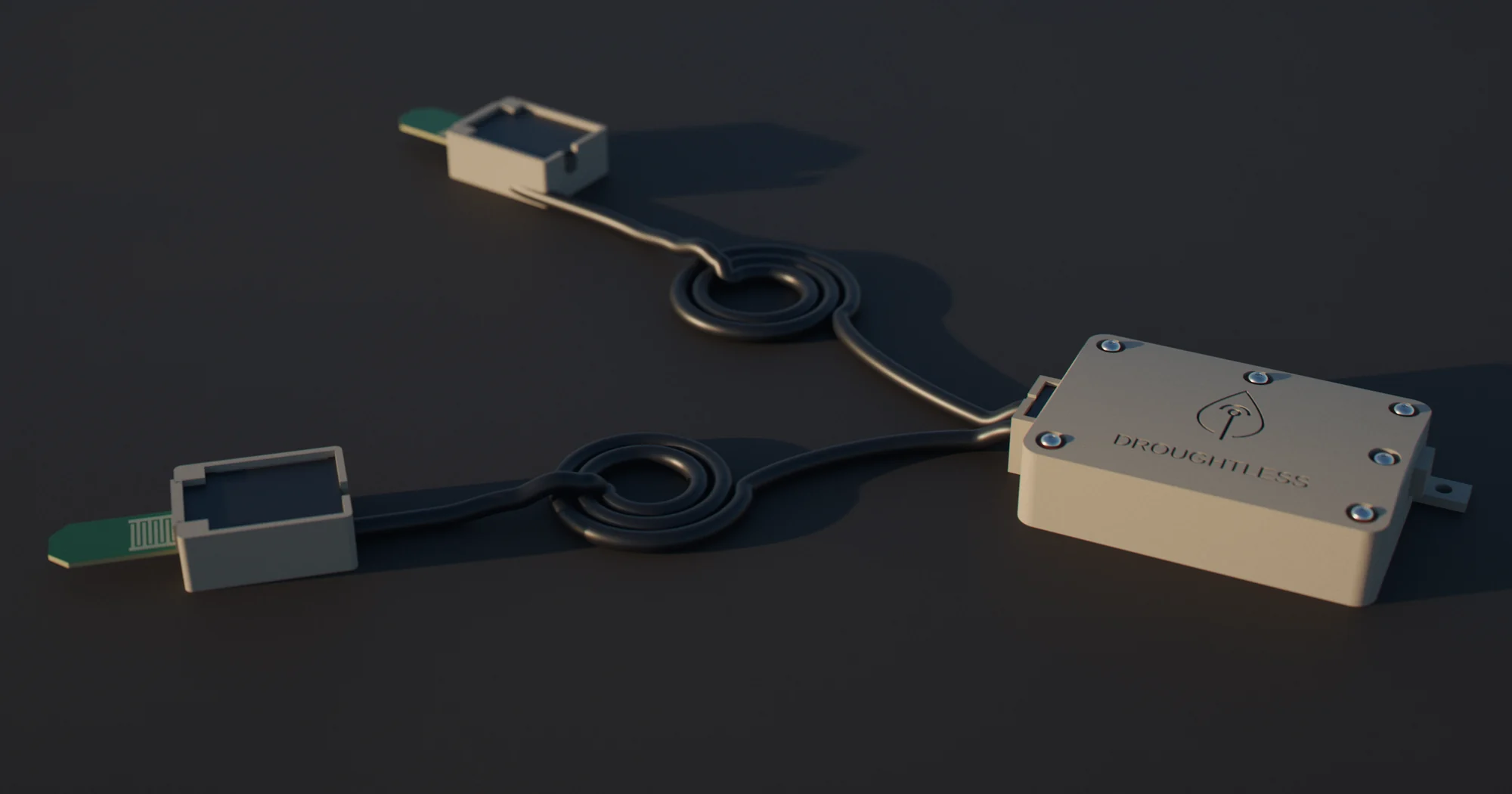
Up to two probes at two depths in the root zone, reporting to the One over an encrypted radio link. Built to run for years on two lithium AA cells.
| Specification | The One | Sense |
|---|---|---|
| Role | Watches your controller, then drives the valves | Measures soil moisture at root depth |
| Capacity | 32 zones on four 8-zone cartridges, plus two pump or master-valve outputs | Up to two probes per node |
| Sensing | Clamp input for your existing controller; solenoid current on the valves it drives | Soil moisture at each probe depth |
| Power | 24 VAC from the site | Two lithium AA cells, built to last years |
| Connection | LTE, off your property’s network | 915 MHz LoRa radio to the One, AES-128 encrypted |
| Security | Per-device certificate for every connection | Per-device encryption key |
| Install | Wall mount beside your controller | Node at mulch level; probes at 10 cm for turf, 15 and 45 cm for trees |
The web app for every site you run. The iOS app for walking a site, pairing sensors and checking work in the field.
Download a site once and walk it offline. Photos and AR captures sync when you’re back in coverage.
Contractors switch between client organizations. Owner, Editor and Reviewer roles cover an organization; Viewer, Installer and Surveyor access covers a single site.
Each new alert is investigated automatically. You see the likely causes, the evidence for each and what to check on site.
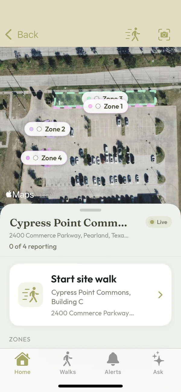
Your maps, readings, photos and configuration belong to you.
Every One connects with its own certificate. Every Sense encrypts its readings with its own key. LTE keeps all of it off your property’s network.
Google, Microsoft or a passkey. Organization roles and site access decide who sees what.
We don’t sell your personal information, and we don’t use your site or sensor data to train third-party AI models. Your data is stored in the US and exported on request.
Aggregated data that can’t identify you or your site helps us run and improve the service.
We agree the sites, equipment, dates and checks before anyone installs anything. It starts in Watch, with your schedule in charge.
The hardware is ours. We install it, watch the site and take it out.
Nothing bills automatically. Anything after the pilot is a separate written offer.
Either side can end it. Any time, no reason needed. We take the hardware out, and in Watch your controller never changed.
One page before install. Site access, our certificate of insurance and your ownership of the data.
The assessment is free. We’ll come back with proposed coverage, equipment and pilot scope.