Autonomous irrigation · built on soil physics
Less water,
greener turf
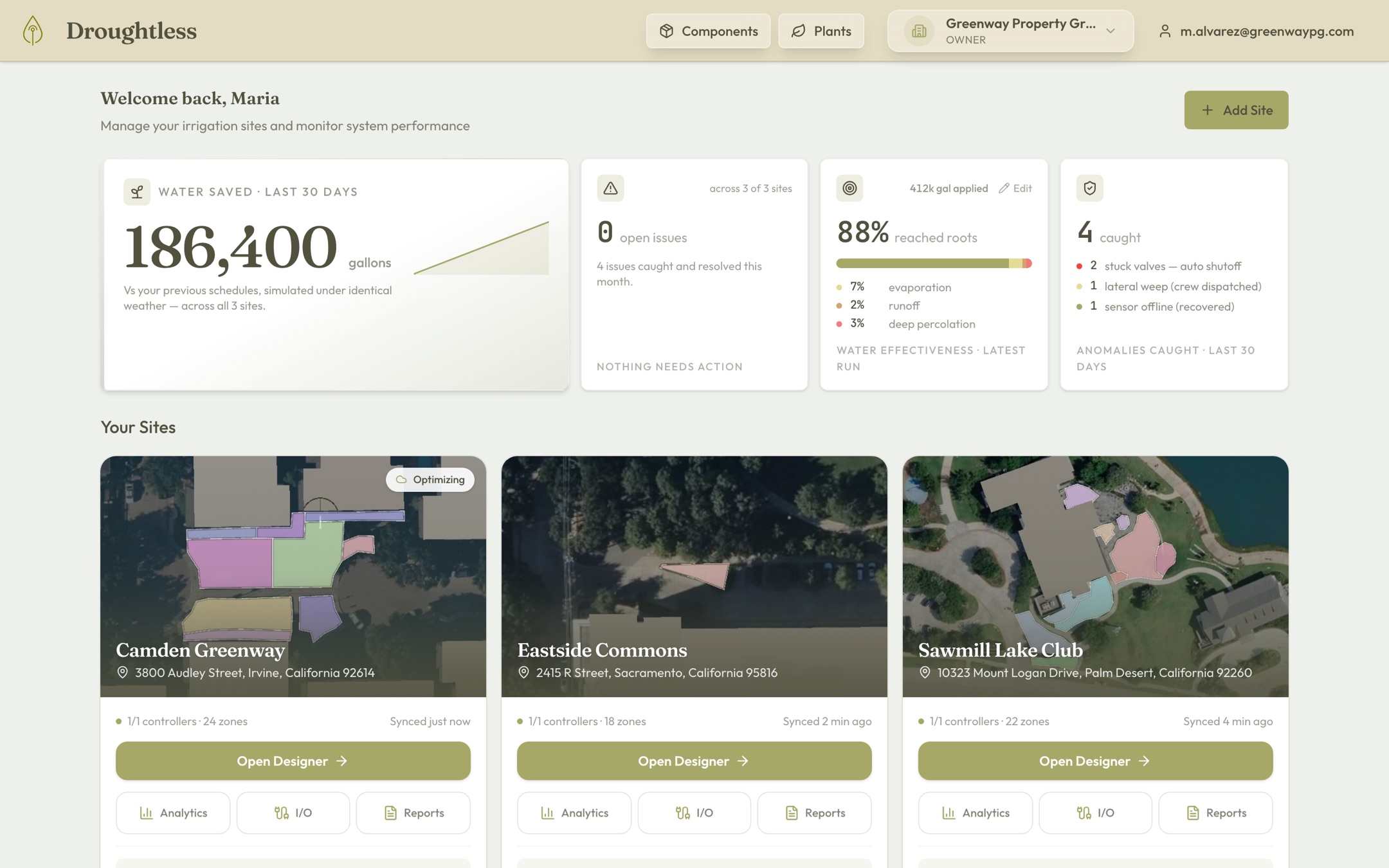
Droughtless helps irrigation managers do more with less. A physics model of your property decides every watering minute — and shows you the results before you buy.
ONBOARDING A SMALL NUMBER OF PROPERTIES THIS YEAR
How it works
The best irrigation schedule for your site and goals
Model
We build a physical model of your site from your irrigation equipment and layout, then layer in terrain, buildings, vegetation, and soil composition.
Listen
The system listens to live humidity, temperature, wind, and sunlight on your site — plus rain and flow at the controller.
Simulate
A physics optimizer simulates water moving through your soil and pipes across 51 weather futures, then solves for the schedule that fits your water budget and plant health.
Tune
Wireless soil-moisture sensors close the loop, sharpening the model of your site with every cycle.
Why not a “smart” controller?
Timers guess. ET controllers estimate. Droughtless simulates.
Weather-based controllers replace a fixed runtime with yesterday’s evapotranspiration estimate, then stop. They don’t know your soil, can’t see your pipes, and can’t prove what they saved.
| Timer controller | “Smart” ET controller | Droughtless | |
|---|---|---|---|
| Decides from | Fixed runtimes on fixed days | A daily ET lookup | Physics simulation of your soil and pipes across 51 weather futures |
| Your soil | Ignored | One generic curve | Per-zone, sensor-calibrated, self-correcting |
| Your pipes | Ignored | Ignored | Pressure and flow validated for every scheduled minute |
| A valve sticks open | Runs all night | Runs all night | Detected by its current signature and shut off automatically |
| Savings claim | None | A marketing estimate | Counterfactual simulation vs your old schedule: same weather, gallon by gallon |
| Compliance filing | You, by hand | You, by hand | Generated from live data and delivered on schedule |
From assessment to autopilot
Three steps. Then it’s off your plate.
It starts from a satellite photo
We draw your zones from imagery and build a working digital twin at the desk: soil, slopes, vegetation, hydraulics. You see the projected savings before anyone sets foot on your property.
Watch it work first
For 60 days, the system runs in shadow mode alongside your current schedule, controlling nothing. You see exactly what it would have done, and what it would have saved, before it takes over.
You monitor, not manage
Once you’re confident, flip the switch. It senses, decides, acts, and flags only what matters. You spend less time on irrigation and more on everything else.
See what your site would save — before you change anything.
We’ll build a working model of your property from satellite imagery and show you the gallons and dollars on the table. No site visit required, no hardware to buy, no commitment. We’re onboarding a small number of properties this year.